|
MENUS! STOREFRONTS!
Guide book STILL Available - Free Downloads Only! In COLOR! |
|
|
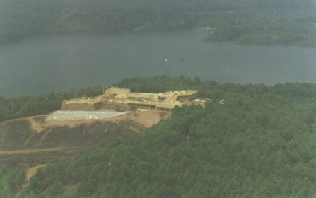
Lake George & Fort William Henry (refer to pages 24-29, 49 & 50 in On the Trail of the
Last of the Mohicans) Linville Access Area on Lake James, Burke County Heat, humidity, thunderstorms, a strike, long, long night shoots ... all
marked the filming at this location. For the locals, it was a treat, though an
inconvenience (road closed). Fireworks every night in the form of cannonades
& musket volleys; boat rides on the lake to watch the fort take shape. It
was such a well-known location that I had no trouble at all locating it.
Practically everyone knew where this one was, and consequently, it was the
second location I was able to pinpoint and photograph. The one day that all explosions were going off, everything is coming down
to the wire ... the one filming scene, "Alice! Cora! Why are you
here?" That took all night long! ... Eric Hurley Today, all the abatis, all the cannon, the noise & smoke, the fortress
itself, are long gone. Standing there near the road, you’d be hard pressed to
identify the bluff before you as having had Fort William Henry upon it at one
time. Nature has reclaimed this site. The pine trees are tall now, there is no
clearing. Up on top, on the fort site itself, you can still locate the
foundations, and perhaps a scrap of wood here and there. That’s about it. No
views, of any consequence, can be had. The forest is that dense today. ~~~~~~~ This area is a public access. However, gun clubs lease the land from a
subsidiary of the Duke Power Company. Please use caution & courtesy! ~~~~~~~ or |
|
|

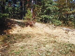 Your best bet, if visiting this location, is to park at the Access Area’s
parking lot. Walk the road, guide book in hand. You should be able to determine,
from the photos, where the fort was; where the French artillery had been placed.
Your best bet, if visiting this location, is to park at the Access Area’s
parking lot. Walk the road, guide book in hand. You should be able to determine,
from the photos, where the fort was; where the French artillery had been placed.
 As you look at the fort site, the road to your right was the location of the
French encampment. Go back down to the parking area. Looking at the lake, before
you is the island. To your left, about 1000 yards or so, is the canoe launch,
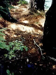
identified by the red clay. You can walk over to it. Beyond that, perhaps
another 250 yards, or so, is the place where Duncan, during the Massacre Valley
sequence, falls down and finds himself with the lake at his back. Across the
cove (a part of the Canoes sequence) is the Magua/Montcalm meeting place, right
there at the point. Filmed here, too, was the burial scaffold seen during the
Burial Ground scene. But, did it make the final cut? Or was a scaffold at the
Biltmore used? It’s but one of the enduring little mysteries of the quest for the
locations!
As you look at the fort site, the road to your right was the location of the
French encampment. Go back down to the parking area. Looking at the lake, before
you is the island. To your left, about 1000 yards or so, is the canoe launch,
identified by the red clay. You can walk over to it. Beyond that, perhaps
another 250 yards, or so, is the place where Duncan, during the Massacre Valley
sequence, falls down and finds himself with the lake at his back. Across the
cove (a part of the Canoes sequence) is the Magua/Montcalm meeting place, right
there at the point. Filmed here, too, was the burial scaffold seen during the
Burial Ground scene. But, did it make the final cut? Or was a scaffold at the
Biltmore used? It’s but one of the enduring little mysteries of the quest for the
locations!